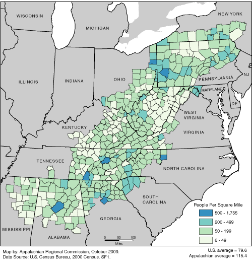
Population density is a measure of the dispersion of people, which is calculated by dividing the 2000 census population by the 2000 land area in square miles. Population density ranges from six to 1,755 people per square mile, with an Appalachian Region average of 115.4. The U.S. average is 79.6. For a list of county data by state, see the downloadable Excel file.